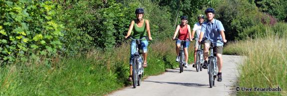
Rhinehesse bike routes

Vacationers who are enthusiastic about cycling will find a network of routes in the Alzeyer Land that leaves nothing to be desired. Many of the towns are connected to each other and, of course, to supra-regional cycle paths and long-distance cycle routes such as the Rhine Cycle Path.
Four of the nine Rhine-Hessian cycle routes run through our vacation region:
Appelbach Cycle Path
The cycle path accompanies "the Appel" as the watercourse is also called, along the entire route in the steadily widening valley. With the exception of 5 km between Tiefenthal and Neu-Bamberg, it runs on its own paths and connects the Donnersberg region with the Nahe valley.
Route info:
Start: Marienthal log cabin, hikers' parking lot
Finish: Nahe bike path near Planig north of Bad Kreuznach
Distance: 42.27 m
Ascent: 539 m / Descent: 302 m
Duration: 150 m
Highest point: 343 m
Lowest point: 99 m
Hiwwel-Route
The Hiwwel route uses many other bike routes in parallel and therefore connects many themed trails and bike routes.
Maybe there aren't really 1,000 hills, but it feels like there could be that many. On the total of 164 kilometers of Hiwwel Route
, you cycle over some of them. The Rhinelanders affectionately call them "Hiwwel." From Bingen in the northwest via Mainz into the heart of Rheinhessen to Wörrstadt and Alzey to the southeast to Worms, the route makes two large arcs through the region in four daily stages. The ideal tour to discover Rheinhessen with its many facets. It has many points of contact with other Rhine-Hessian theme routes and thus allows some interesting combinations for individual route planning. At the Rhein-Nahe-Eck in Bingen - the gateway to the "UNESCO World Heritage Upper Middle Rhine Valley" - the Hiwwel route has a connection to the two long-distance cycle routes Rhine and Naheradweg.
Route info:
Start: Bingen Rhein-Nahe-Eck/Rhein-Radweg and Nahe-Radweg
Finish: Worms Rhein-Radweg
Distance: 163.85 km
Ascent: 1,452 m/Descent: 1,445 m
Duration: 660 min
Highest point: 301 m
Lowest point: 79 m
Mühlen-Radweg
Between the Selz River and the Rhine, you trace old mills on this tour, accompanied by small watercourses
and passing quietly romantic villages, until you reach the Rhine plain and arrive at Gimbsheim through the area of a silted-up branch of the Old Rhine
. An ideal connection of the Selztal and Rhine cycle paths.
The Mühlen-Radweg connects, past many former mill sites, the Selz with the Rhine. In particular, the Seebach once drove many mills through its abundance of water. A gem is the idyllic and generously framed Seebach spring in the old Westhofen village center. Further mill and stream views worth seeing are offered in Osthofen, before the flat and almost seemingly boundless Rhine plain picks up the Mühlen-Radweg via Rheindürkheim to the Rhine and to Gimbsheim.
Route info:
Start: Framersheim Selz Cycle Path
Finish: Gimbsheim
Distance: 41.96 km
Ascent: 213 m/Descent: 275 m
Duration: 150 min
Highest point: 223 m
Lowest point: 85 m
Selz Valley Cycle Path
The Selztal-Radweg is an easy, representative crossing of Rheinhessen along the river Selz from the southern hill country over the hilly country to the Rhine.
The Selztal-Radweg gives a good cross-section of Rheinhessen from the Nordpfälzer Bergland over the Rheinhessische Hügelland to the Rhine. The worth seeing Volker city Alzey and the former imperial palace and today's red wine city Ingelheim included. From the source to the mouth of the river, charming, wide valleys alternate with gentle hills. A varied, day-filling discovery tour. If you want to take it easy and take advantage of the many opportunities
for wine stops along the way, simply end the tour in Nieder-Olm or Alzey.
Route info:
Start: Selzquelle east of Orbis
Destination: Ingelheim-Nord Rhein-Radweg
Route: 68.07 km
Ascent: 353 m/Descent: 591 m
Duration: 240 min
Highest point: 325 m
Lowest point: 80 m

